-
This website was developed by PAGASA in collaboration with the Japan Meteorological Agency/Tokyo Climate Centre (JMA/TCC), the World Meteorological Organization (WMO) Regional Climate Centre in RA II (Asia). This one-month (running 10-day) probabilistic forecast product is being produced and updated every Thursday by PAGASA;
-
This product is based on the output of one-month numerical prediction from Global Prediction Center for Long-range Forecast (GPC) Tokyo and the details of its prediction system are available here: ds.data.jma.go.jp/tcc/tcc/products/model/outline/index.html
-
This sub-seasonal forecast (10-day forecast, but usually weekly or pentad) could provide advance notice of potential hazards related to climate, weather and hydrological events across the country that will eventually support various economic sectors (agriculture, water resource management and others).
Probabilistic Forecast Map
The Subseasonal to Seasonal Forecast
Subseasonal predictions contribute to fill the gap between weather and seasonal time scales.
Objectives:
-
Improve forecast skill and understanding on the subseasonal to seasonal timescale with special emphasis on high-impact weather events.
-
Promote the initiative’s uptake by operational centers and exploitation by the applications community.
-
Capitalize on the expertise of the weather and climate research communities to address issues of importance to the Global Framework for Climate Services.
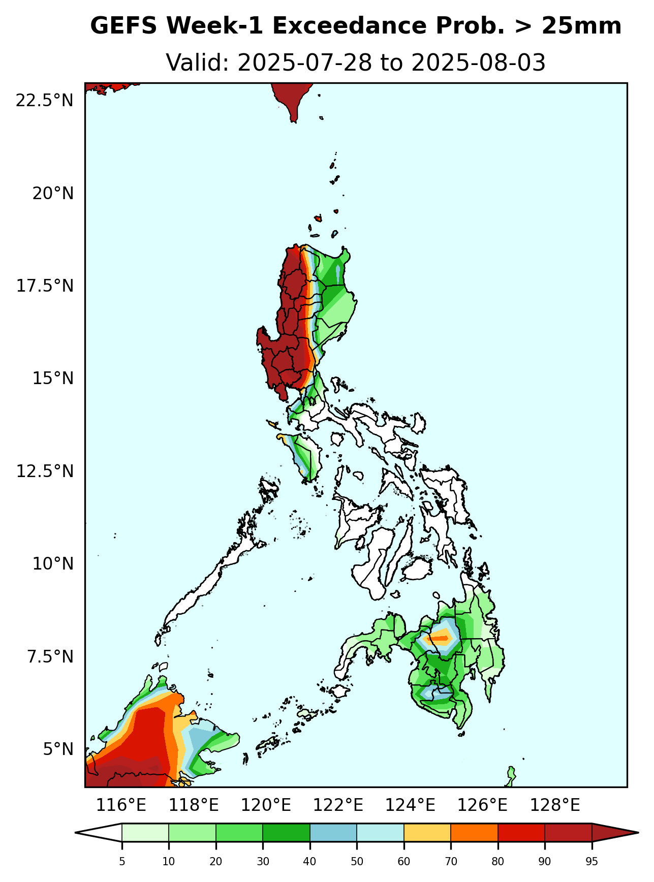
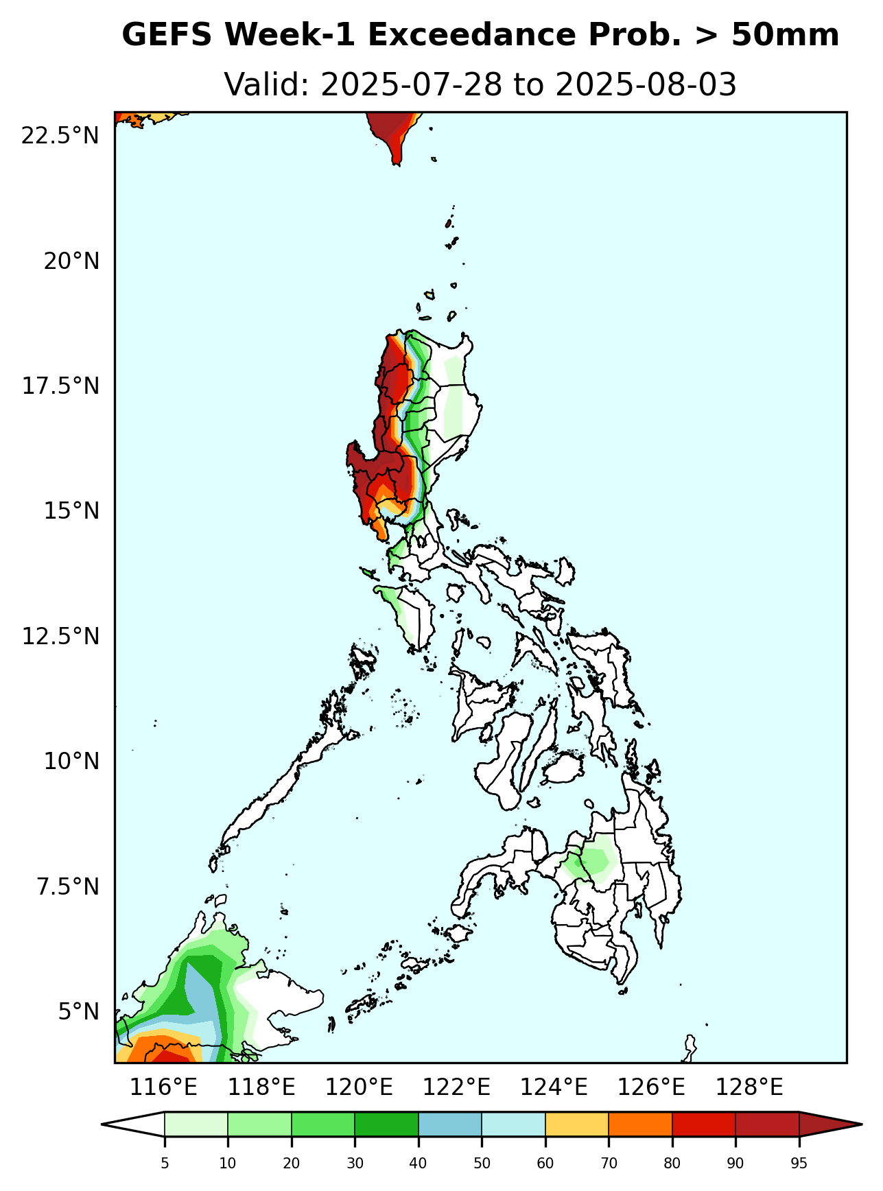
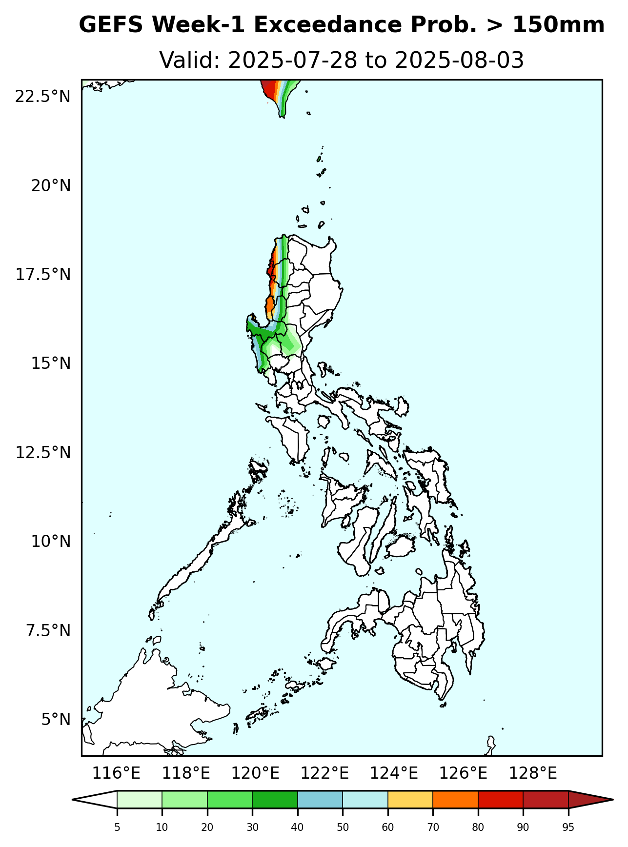
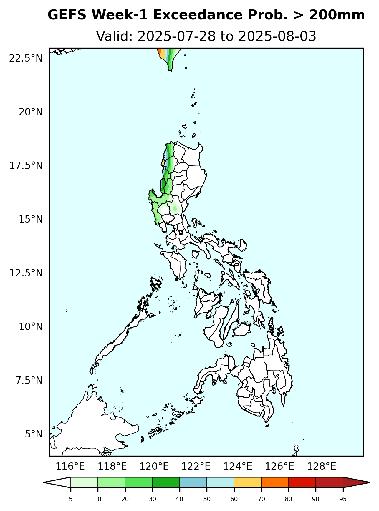
Initial Condition: July 27, 2025
Week Validity: July 28 - August 03, 2025
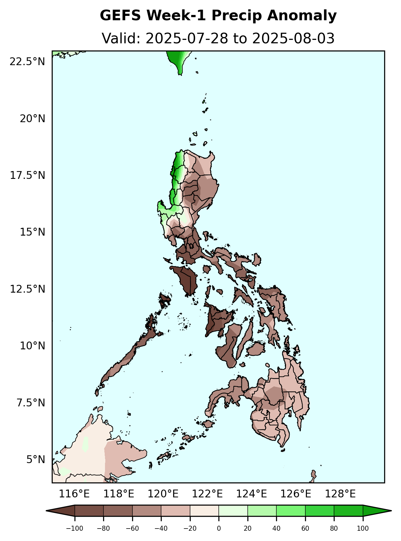
Increase in rainfall of 80-100mm is expected over most parts of Ilocos Region, Abra and Benguet while 80-100mm rainfall deficit is likely over the rest of the country.
Probability to Exceed 25mm
Probability to Exceed 50mm
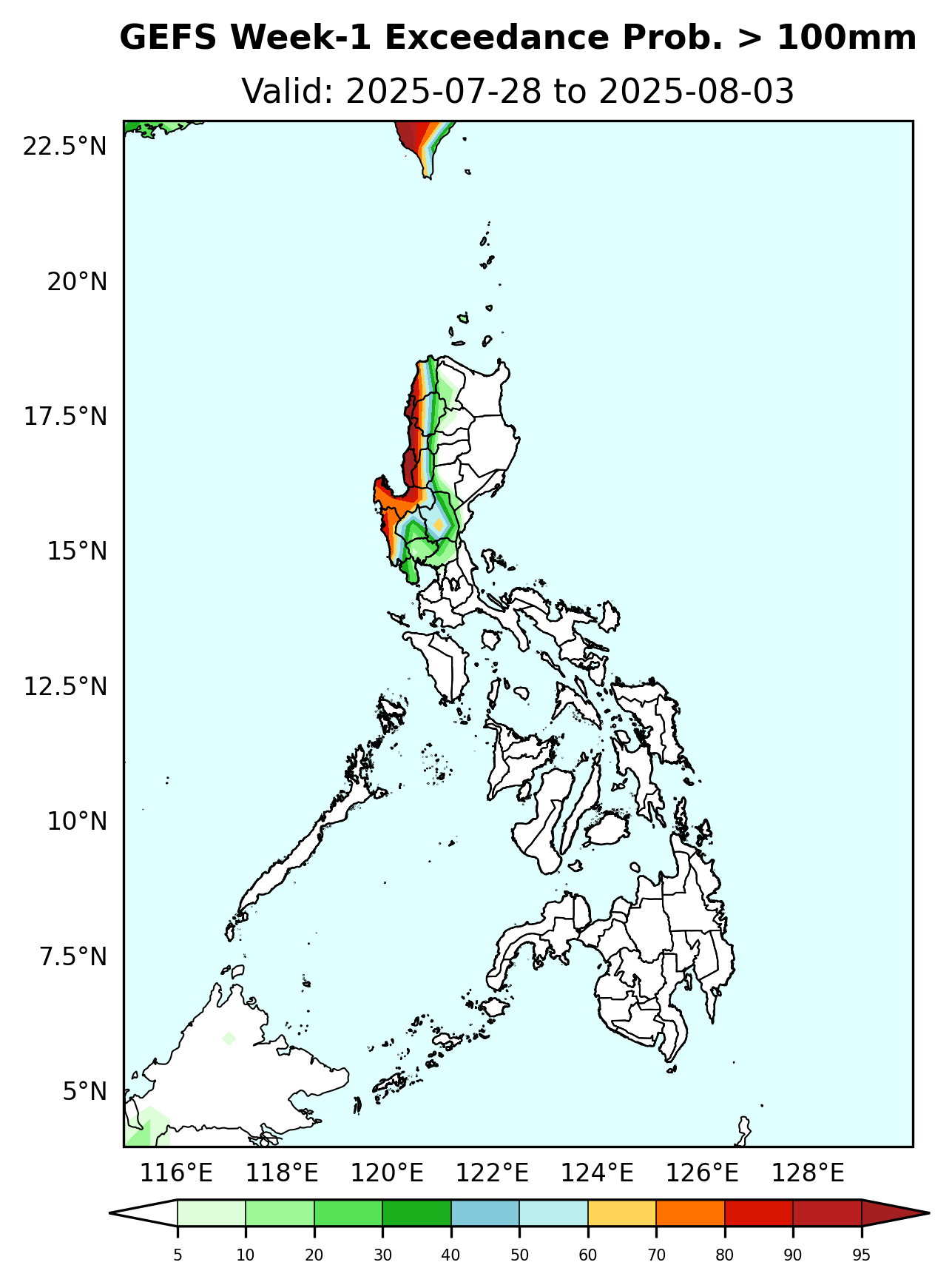
Probability to Exceed 100mm
Probability to Exceed 150mm
Probability to Exceed 200mm
Initial Condition: July 27, 2025
Week Validity: July 28 - August 03, 2025
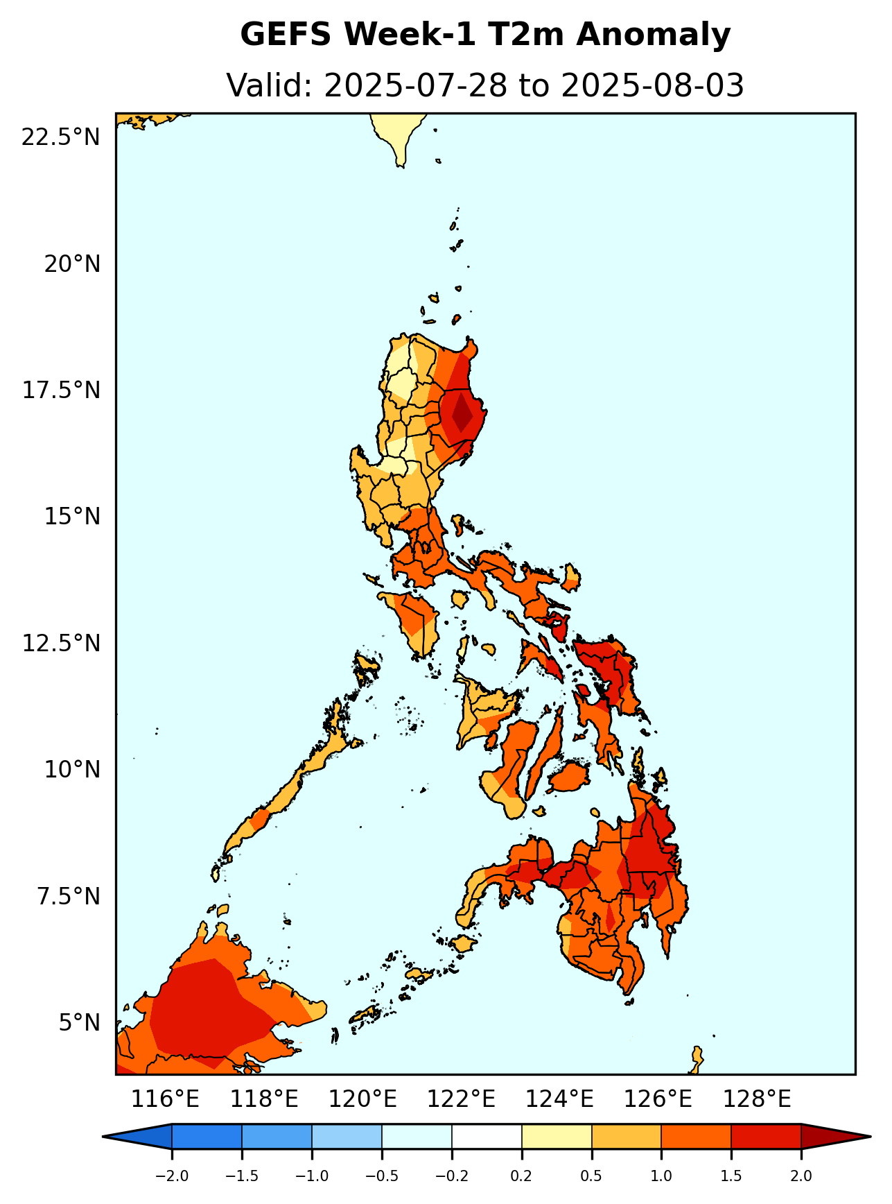
Slightly warmer to warmer than average surface air temperature will likely be experienced in most parts of the country.
Initial Condition: July 27, 2025
Week Validity: July 28 - August 03, 2025
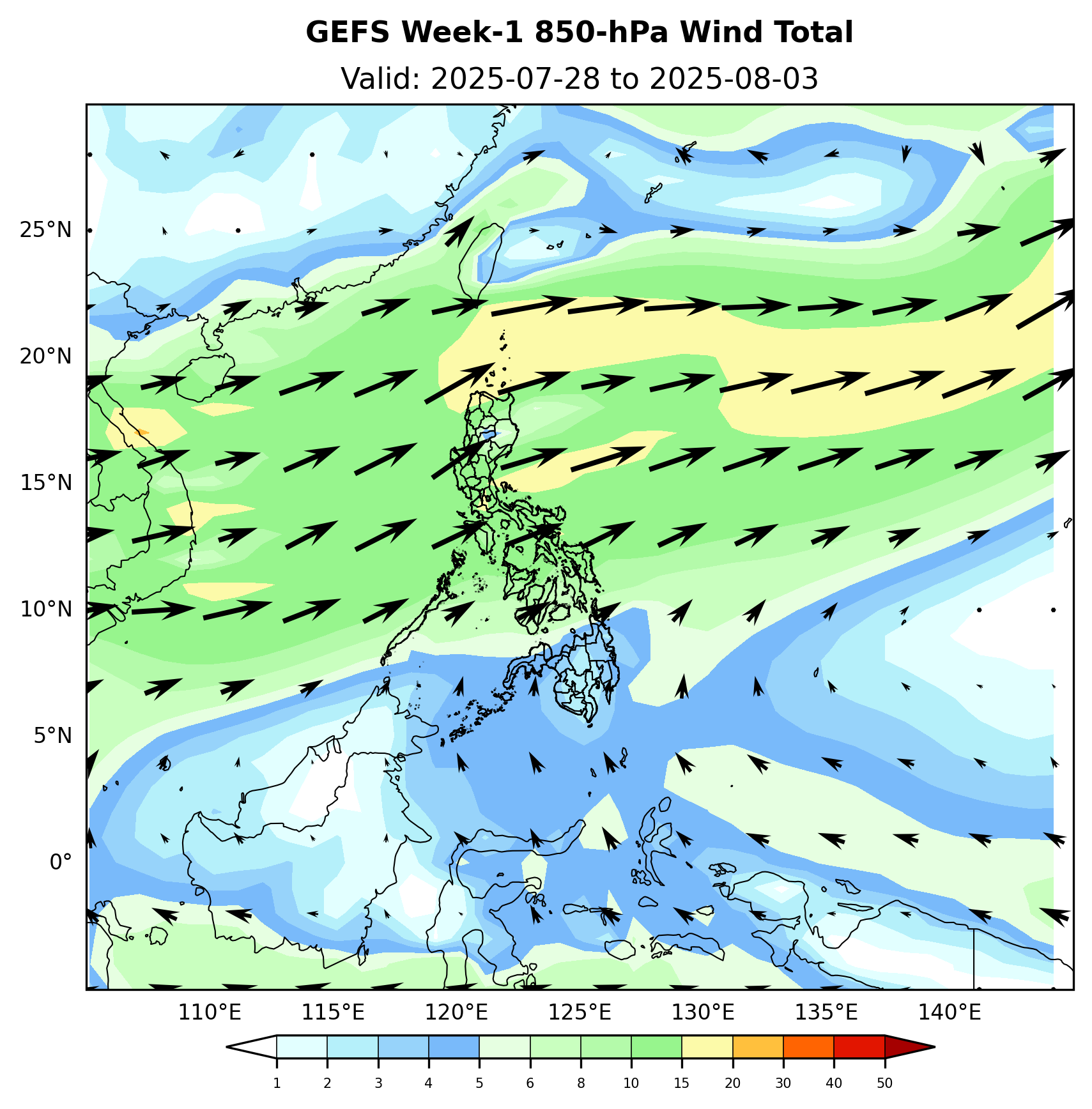
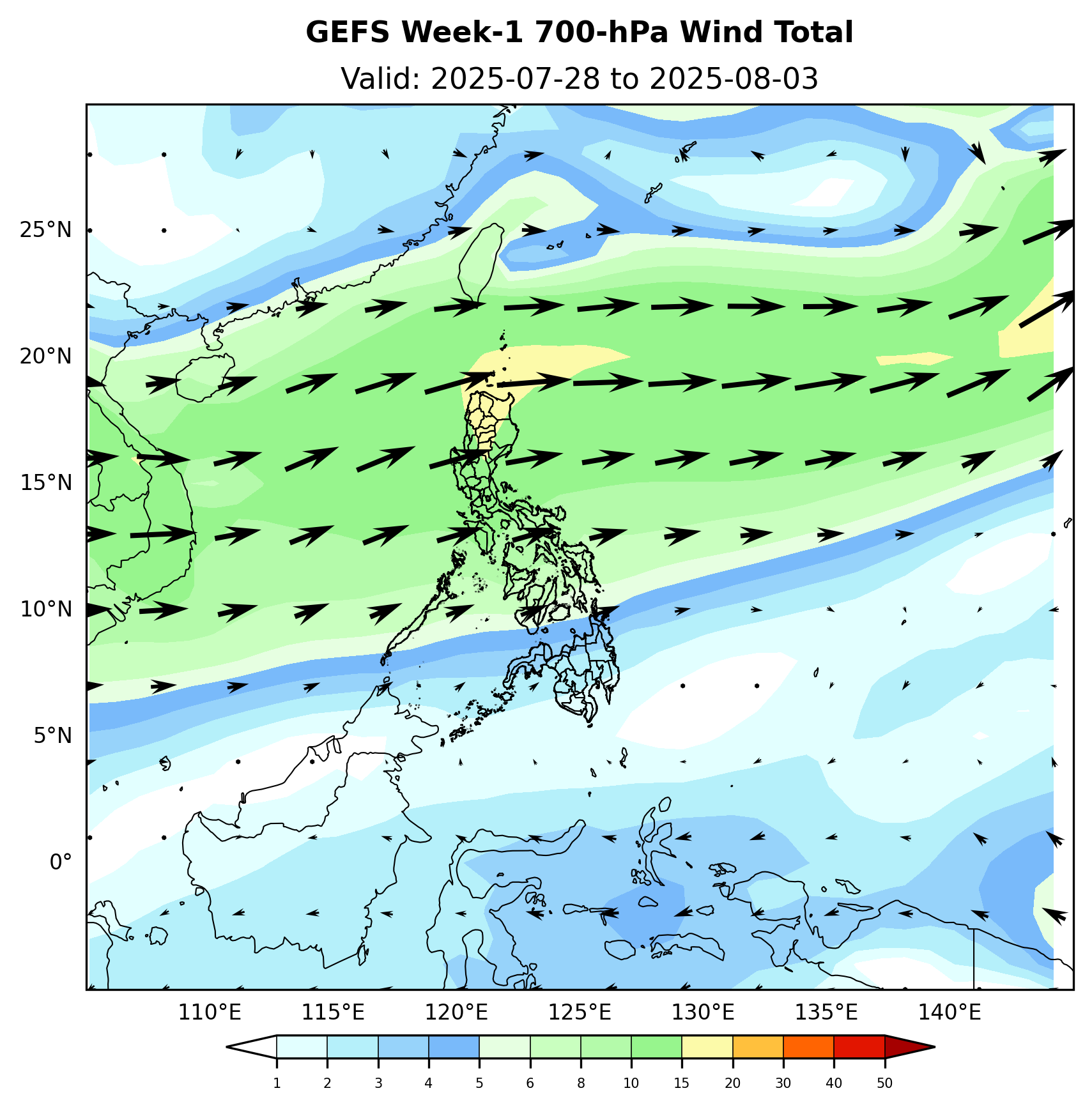
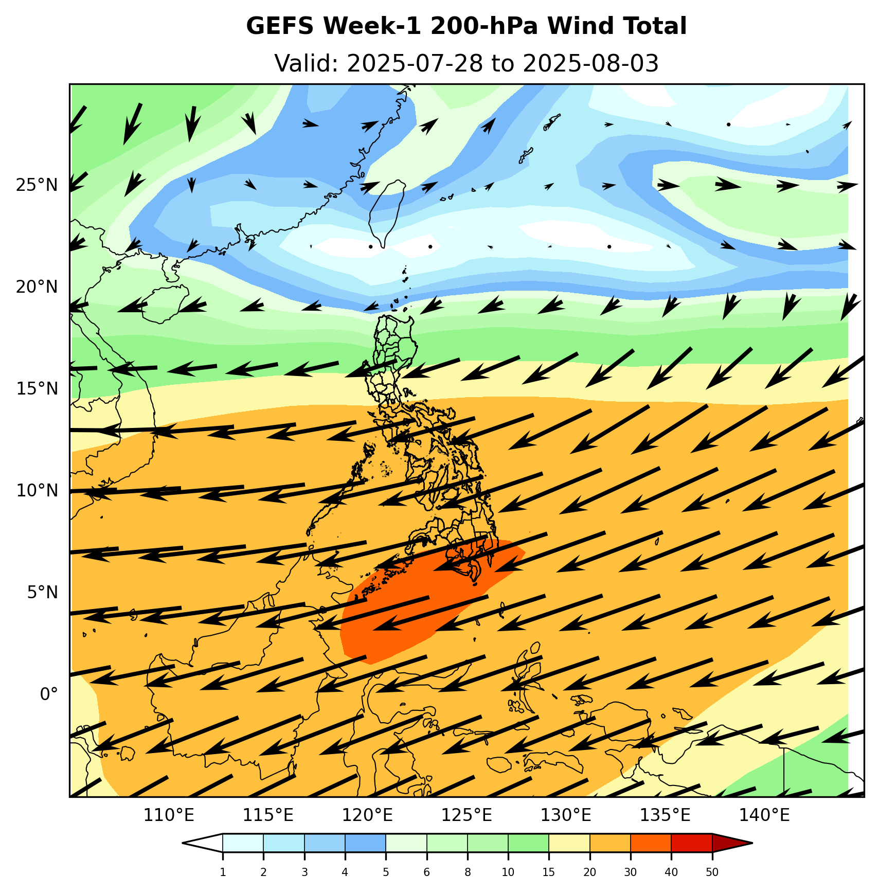
Enhance SW Monsoon will likely affect the Western section of Luzon. Easterlies will likely affect the rest of the country.
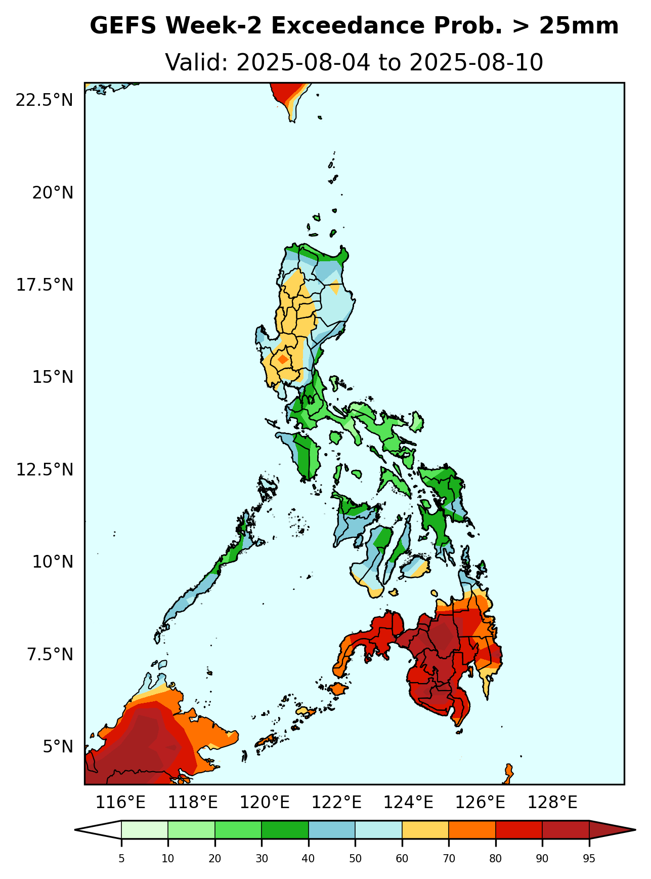
Initial Condition: July 27, 2025
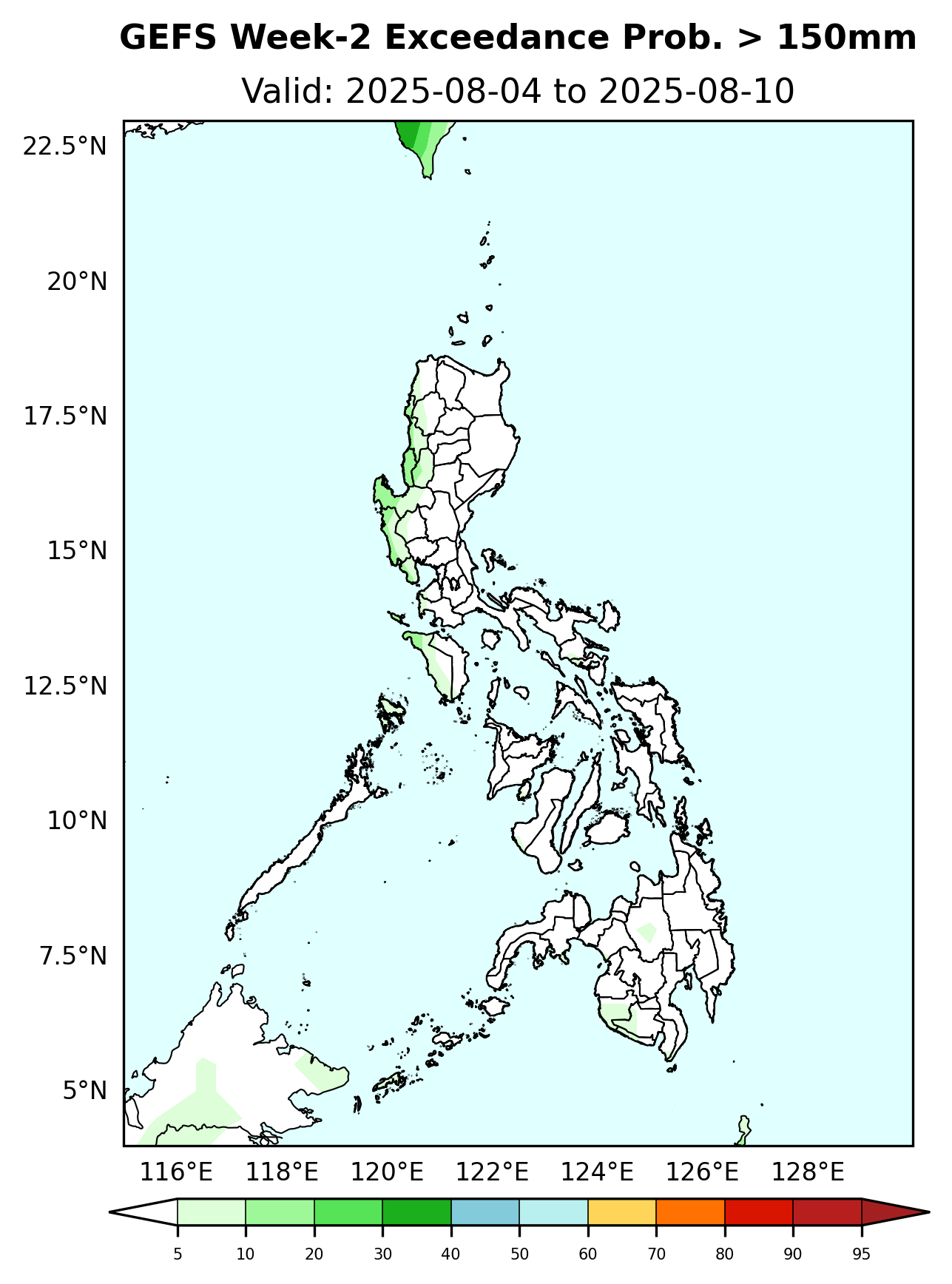
Week Validity: August 04 - 10, 2025
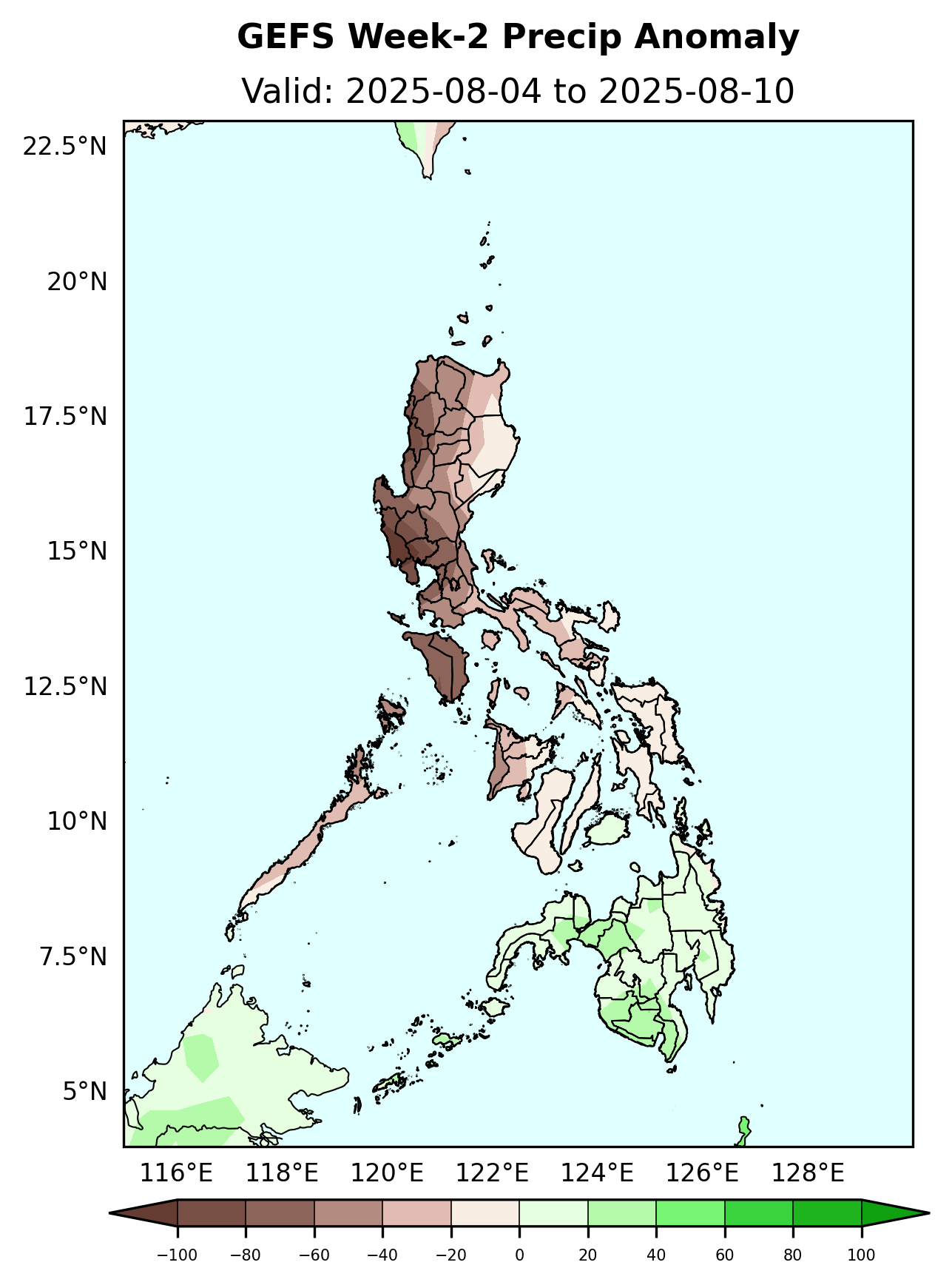
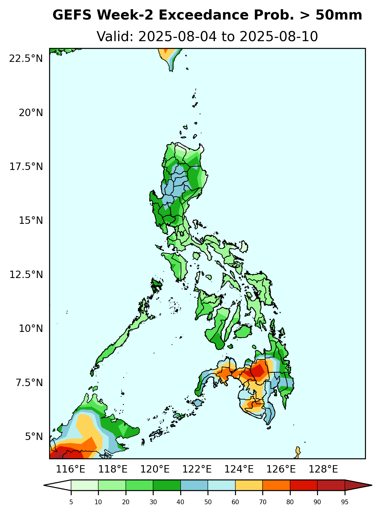
Rainfall deficit 40-100mm is expected over most parts Luzon and Visayas while 20 – 60mm increase in rainfall is likely over Mindanao.
Probability to Exceed 25mm
Probability to Exceed 50mm
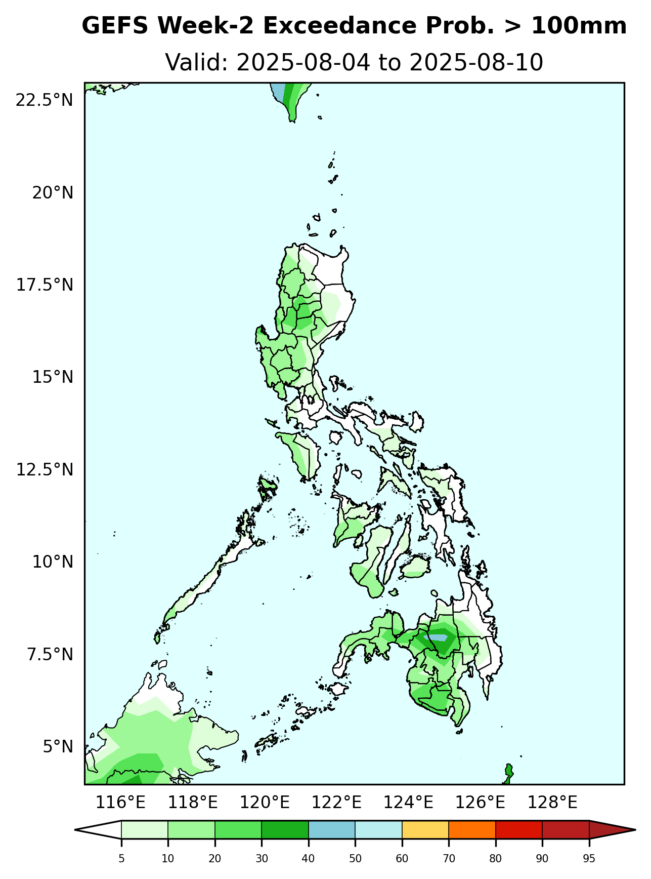
Probability to Exceed 100mm
Probability to Exceed 150mm
Probability to Exceed 200mm
Initial Condition: July 27, 2025
Week Validity: August 04 - 10, 2025
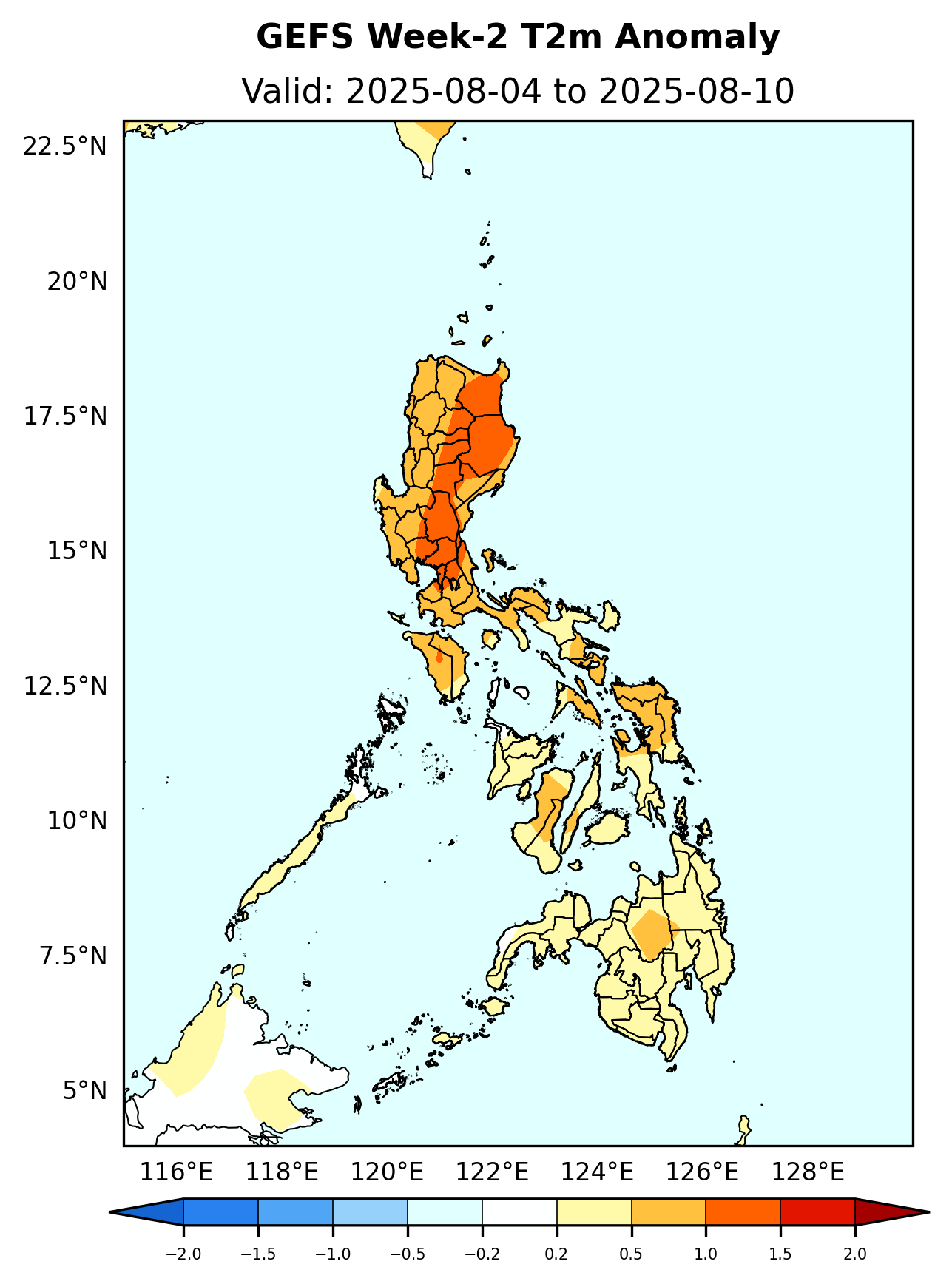
Slightly warmer to warmer than average surface air temperature will likely be experienced in most parts of the country.
Initial Condition: July 27, 2025
Week Validity: August 04 - 10, 2025
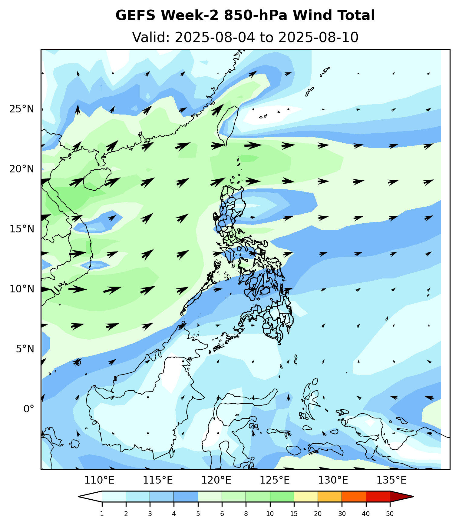
Weak SW Monsoon will likely affect the western sections of Luzon. Easterlies affecting the rest of the country.
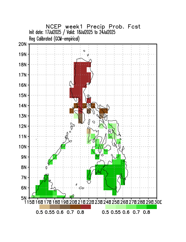
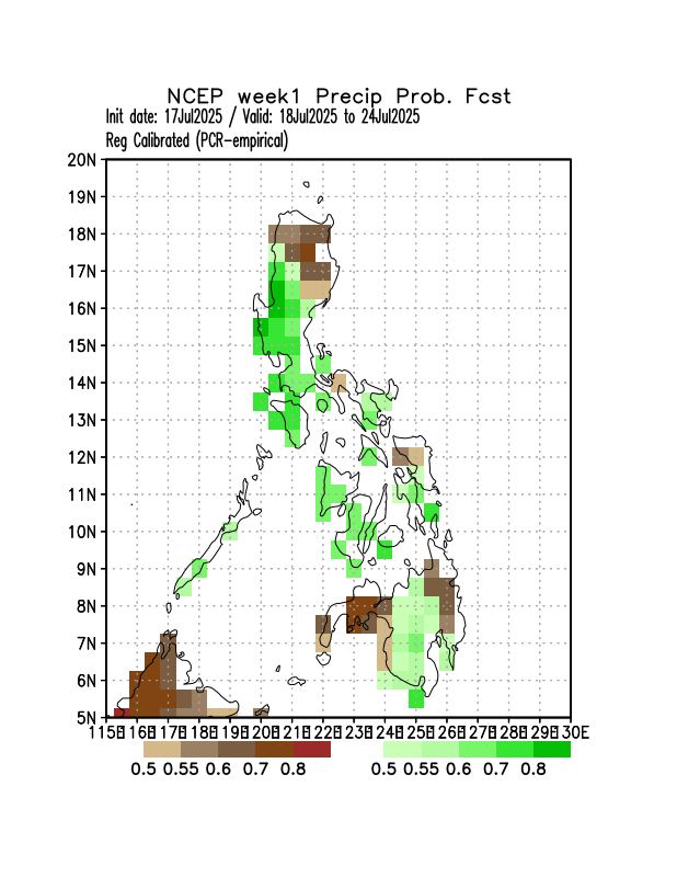
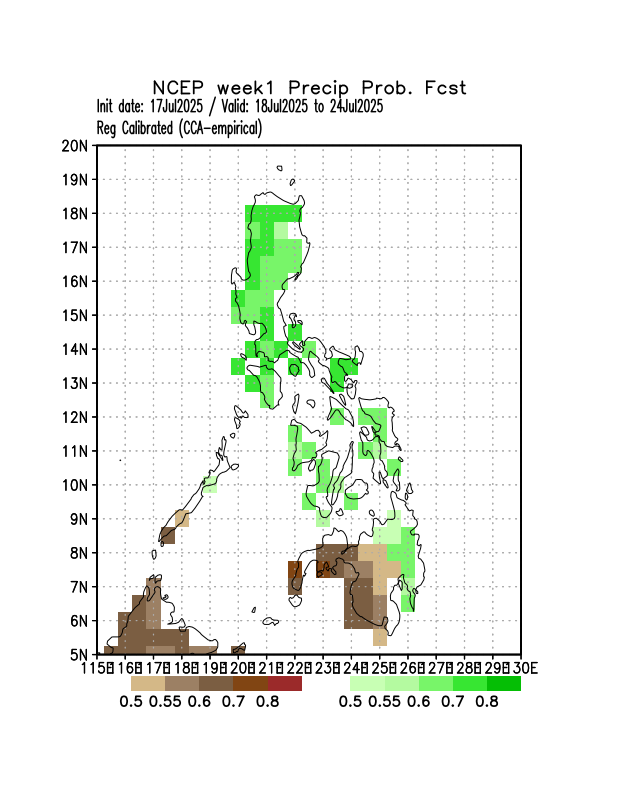
CPT based Sub-Seasonal Forecasting (Philippines)
CPT is using NCEP CFSv2 (Climate Forecast Systems V.2) forecasts.
NOAA's CPC International Desks
The legend is interpreted as, probability of below average for the brown shaded color and probability of above-average for green shaded color.
Initial Condition: July 17, 2025
Week Validity: July 18-24, 2025
GCM
PCA
CCA
Probability of receiving below normal rainfall in most parts of Luzon while Masbate, Palawan, Visayas, and Mindanao will likely have above normal rainfall.
Probability of receiving above normal rainfall in most parts of the country except in in some areas in extreme northern Luzon, Isabela, northern Samar, Zamboanga Peninsula, and eastern Mindanao where below normal rainfall is expected.
Probability of receiving above normal rainfall in most parts of Luzon, Visayas, and western Mindanao while the rest of Mindanao will likely have below normal rainfall.
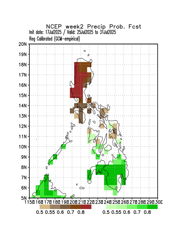
CPT based Sub-Seasonal Forecasting (Philippines)
CPT is using NCEP CFSv2 (Climate Forecast Systems V.2) forecasts.
NOAA's CPC International Desks
The legend is interpreted as, probability of below average for the brown shaded color and probability of above-average for green shaded color.
Initial Condition: July 17, 2025
Week Validity: Jul 25-31, 2025
GCM
PCA
CCA

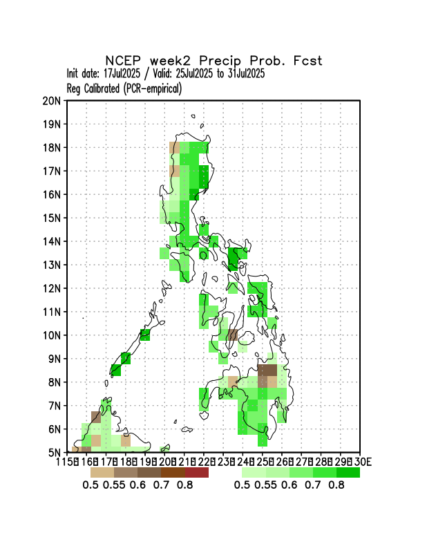
Probability of receiving below normal rainfall in most parts of Luzon and eastern Visayas while Palawan, the rest of Visayas, and most of Mindanao will likely have above normal rainfall.
Probability of receiving above normal rainfall in most parts of the country except in some areas in Bukidnon where below normal rainfall is expected.
Probability of receiving above normal rainfall in most parts of the country.
CPT based Sub-Seasonal Forecasting (Philippines)
CPT is using NCEP CFSv2(Climate Forecast Systems V.2) forecasts.
NOAA's CPC International Desks
The legend is interpreted as, probability of below average for the brown shaded color and probability of above-average for green shaded color.
Initial Condition: July 17, 2025
Week Validity: Aug 1-14, 2025
GCM
PCA
CCA
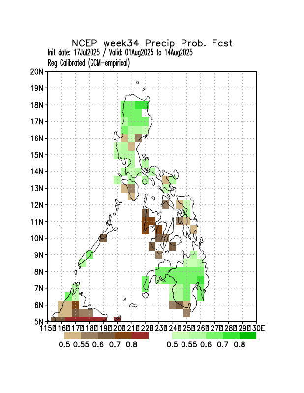
Probability of receiving above normal rainfall in most parts of Luzon, Samar provinces, and most parts of Mindanao while Mindoro, northern Palawan and the rest Visayas will likely have below normal rainfall.
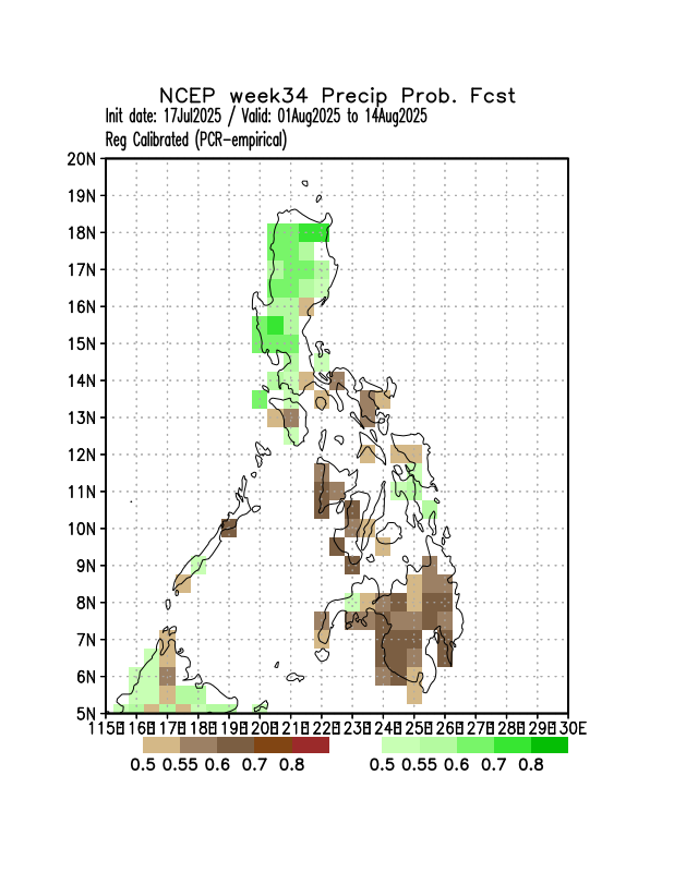
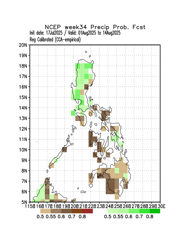
Probability of receiving above normal rainfall in most parts of Luzon, northern Samar, and Leyte provinces while Bicol Region, MIMAROPA, the rest of Visayas and most parts of Mindanao will likely have below normal rainfall.
Probability of receiving above normal rainfall in most parts of Luzon, northern Samar, and Leyte provinces while Bicol Region, MIMAROPA, the rest of Visayas and most parts of Mindanao will likely have below normal rainfall.
CPT based Sub-Seasonal Forecasting (Philippines)
CPT is using NCEP CFSv2(Climate Forecast Systems V.2) forecasts.
NOAA's CPC International Desks
The legend is interpreted as, probability of below average for the brown shaded color and probability of above-average for green shaded color.
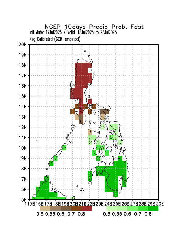
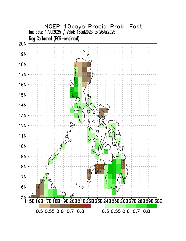
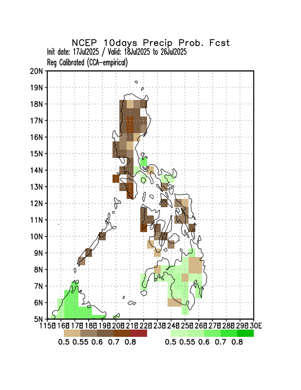
Initial Condition: July 17, 2025
Week Validity: July 18-26, 2025
GCM
PCA
CCA
Probability of receiving below normal rainfall in most parts of Luzon while Masbate, Palawan, Visayas, and Mindanao will likely have above normal rainfall.
Probability of receiving above normal rainfall in most parts of the country except in isome areas in extreme northern Luzon, Isabela, Camarines Sur, Albay, Zamboanga Peninsula, and Surigao del Sur where below normal rainfall is expected.
Probability of receiving below normal rainfall in most parts of Luzon and Visayas while Bicol Region, Marinduque, and most parts of Mindanao will likely have above normal rainfall.